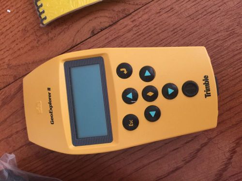
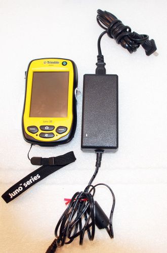
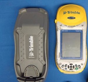
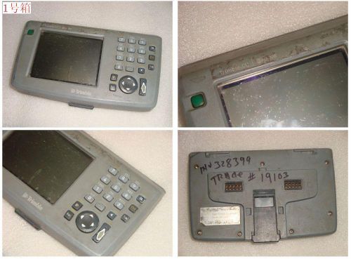
Trimble GeoExplorer II Pocket-sized GPS mapping system New Purchased for a university geology department but stayed in the lab all the time. Tested before listing and it works perfectly. Trimble’s GeoExplorerTM II mapping system is a pocket- sized, lightweight GPS receiver with user-friendly processing software designed for mapping and GIS data collection. It’s a versatile, powerful and affordable solu- tion for a variety of applica- tions including resource mapping. The GeoExplorer II system incorporates all of the features that made the original GeoExplorer system one of the most popular and widely used GPS mapping products today, plus standard submeter accuracy and optional external antennas. The GeoExplorer II is part of the GPS PathfinderTM Series, so it has many of the benefits found only in a Trimble GPS mapping system, including reliable, accurate differential GPS and powerful processing software. It's the smallest and lightest GPS mapping system available today. The GeoExplorer II design philosophy emphasizes simplicity so it is easy to learn without sacrificing capability. All of the receiver’s extensive functions operate through an intuitive menu-driven user interface controlled with a seven-button keypad. The receiver stores positions quick- ly with the accuracy necessary for cost-effective asset manage- ment applications. The GeoExplorer II system typical- ly provides two-to-five meter accuracy after differential correction. Using the carrier phase processing module in Pathfinder Office, the GeoExplorer II system yields submeter performance for more demanding applications. For applications that require an external antenna, such as use in a vehicle, the GeoExplorer II system offers an optional plug-in external antenna. In the field, the GeoExplorer II receiver collects and stores up to 9,000 3D GPS positions. Both real- time corrected and uncorrect- ed positions can be stored in a single file in the receiver. The positions not corrected in real-time can be processed back in the office with the post-processing software. The GeoExplorer II system allows you to capture detailed feature and attribute informa- tion. Pathfinder OfficeTM soft- ware is included for data dic- tionary creation, differential correction, and GIS output. The software's Microsoft Windows graphical user interface allows you to easily display, edit, and plot features at any scale. Most GIS and CAD systems are support- ed, including ARC/INFO, AutoCAD, Intergraph MGE, ERDAS, and GRASS. The GeoExplorer II system requires minimal training but offers the power necessary for most mapping and GIS data collection applications. Feature List: Small, lightweight, pocket-sized design Integrated high-performance six-channel GPS receiver and antenna 2-to-5 meter accuracy after differential correction Pathfinder Office software—Microsoft Windows-based software for planning GPS mapping, differentially processing GPS data, GIS output, plotting, and data dictionary creation Carrier phase processing software for submeter accuracy Records points, lines and areas Powered by off-the-shelf AA batteries Tracks up to 8 GPS satellites 1/4 Megabyte internal memory for storage of over 9,000 three-dimensional GPS positions User-selectable map coordinate system display GPS satellite status including Az, El, URA and SNR Average position function Screen backlight for night time operation ASCII, RTCM SC-104 and XMODEM serial protocols Carrying case with belt loop Navigation functions, including range, bearing, cross-track error, and storage for 99 waypoints Real-time differential GPS capability using RTCM SC-104 standard input CE Mark approved
By clicking "Accept All Cookies", you agree to the storing of cookies on your device to enhance site navigation, analyze site usage, and assist in our marketing efforts.