


US $100.00
Directions
Similar products from Other Office Products

(2)pcs,CRAB IS IN, HOME OFFICE SIGN,FUNNY,HOME,OFFICE,SIGN,FUNNY OFFICE SIGN

(3)pcs,OLD CRAB, FUNNY,OFFICE,SIGN,CRABBY,PERSON,CRANKY,FUN SIGN FOR THE OFFICE

(4)pcs, DON'T WORRY, FUNNY SIGN FOR THE OFFICE, CRABBY PERSON,CRAB,BE CRABBY

(2)pcs,BEWARE, OLD CRAB,CRAB,FUNNY,HOME,SIGN,FUNNY OFFICE SIGN,FUNNY,OFFICE
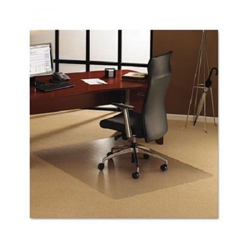
New Floortex Computer Office Chair Mat for Carpet 1113423ER 38x53

Gorgeous Athleta Base Layer Stretchy Shirt Med NWOT Red w/ White Flowers L/S top

Dell PS-5251-2DS 250W ATX Desktop 20-Pin Power Supply OM0148 !VP222

(PACK OF 6)--Y580120 FEED ROLLER ASSEMBLEY (HFL1226 BEARING)
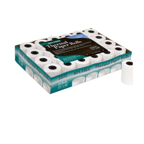
New ! 24 Rolls IBM - Thermal Paper Rolls 2 1/4'' x 85', 58mm #75P3477

Lexmark 601X Extra High Yield Return Program Toner Cartridge NEW OEM

AGENDA LEGALE | PENSIERO GIURIDICO | VERDE - UDIENZE AVVOCATO 2015 ORIGINALE
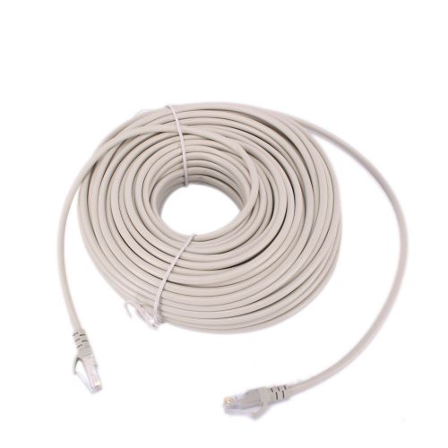
RJ45 Cat5e Network Ethernet Cable Lead LAN Patch Router 2M 3M 5M 8M 10M 14M 15M

AGENDA LEGALE | PENSIERO GIURIDICO | BLU - UDIENZE AVVOCATO 2015 ORIGINALE

Lot of 50 NEW Black 17" Neck Strap Lanyard for ID Badge, Card with Snap Clip

V7Toner Cartridge HP LaserJet P3010 P3015 P3015D P3015DN P3015X P3016 CE255A 6K
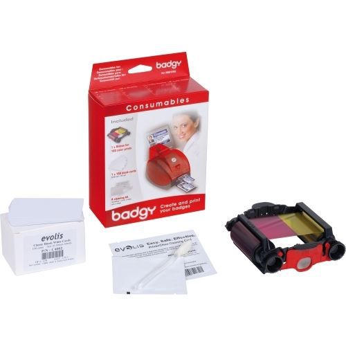
Evolis Badgy Kit Thin cards ribbon cleaner
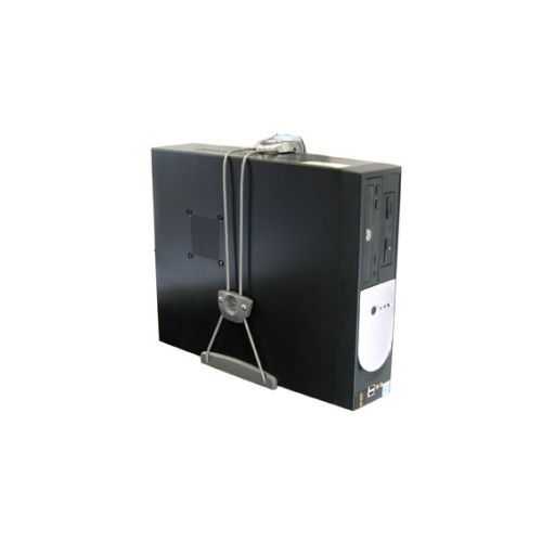
Ergotron 80 105 064 CPU Mount for CPU 50.00 lb Load Capacity
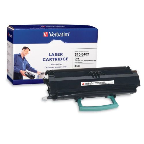
Verbatim Dell 310 5402 Compatible Toner Cartridge 1700Laser 6000 Page 1 Pack

Konica Minolta Standard Capacity Black Toner Laser 2000 Page Black
V7 Black High Yield Toner Cartridge for HP LaserJet Laser 6000 Page
People who viewed this item also vieved
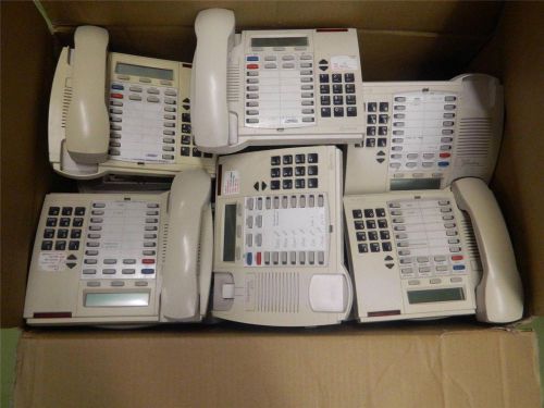
Lot Of 23 MITEL SUPERSET 4025 White Office Business Phones
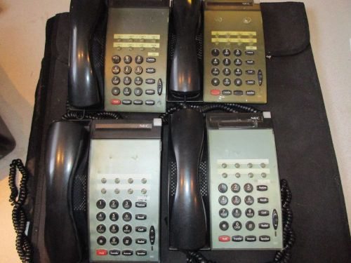
NEC DTU-8-1 (BK) System Telephones - LOT OF 4 - Black (I9)
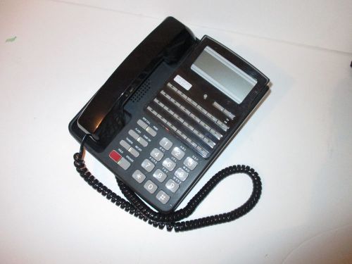
FUJITSU DT24DS F10B-0789-B001 #BK PHONE TELEPHONE BUSINESS 24 KEY FOR F9600
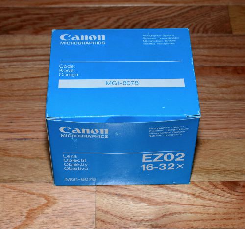
Canon Zoom Lens EZ02 EZ-02 16x32 for Microfilm Scanner MP90 MS300 MS400 IRW 1000
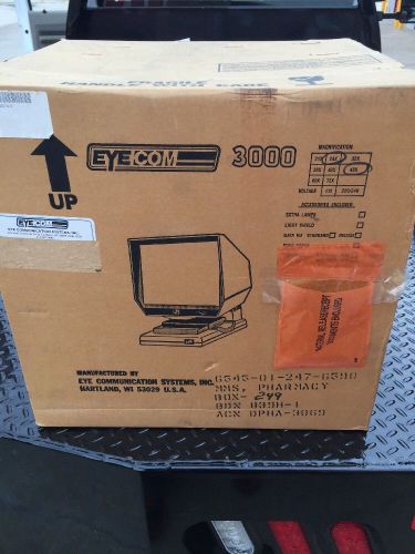
EYECOM 3000 MICROFILM MICROFICHE VIEWER DESKTOP 24X 48X 110V ARCHIVE READER NEW
By clicking "Accept All Cookies", you agree to the storing of cookies on your device to enhance site navigation, analyze site usage, and assist in our marketing efforts.
Accept All Cookies